

Artwork-Archer
For years I just thought waters from Sandy Hook across to Brooklyn near the Verrazano Bridge and west were all part of the Raritan Bay. The area known as Gravesend Bay was, to me, not part of the Raritan Bay. Now that I'm outfitted with a "vessel" that can take me along the shallower shorelines in and around New Jersey and New York I thought it might be good to learn a little more about those areas. While I have fished the Jersey shore west of and including Sandy Hook my New York experiences have only been after I launched my boat from Atlantic Highlands and headed north.
Like many with boats I have fished along the ocean side of Jersey, up and around The Hook, along the Bayshore towns, and across the drink to Perth Amboy. I have fished Staten Island from there east to the Verrazano, up to the Statue Of Liberty, along Coney Island and to Breezy Point. I have done well and not so well at times. And then there's many memories of great fishing between Breezy and The Hook.

Over the last few years my eyes have been opened to the range of the striped bass in and around New Jersey. Each time I go, or spend time online doing some research, I find more waters where they are abundant. These are the fish that I seek. Although I am drawn to the blitzes like an insect to a hanging bug light, the "There's bass in that?" kind of places fascinate me. And the other thing I have learned is new spots to you and I may be regular haunts to a entire mob of people who may not venture down into our honey holes. They tend to "stay home" for the same reasons we do, time, money, and the unknowns. Add to that more confidence on our home waters and exploration becomes risky. To be best prepared to find and catch calls for a fly angler to be dialed in to said spots. Blitz fishing makes it easy. Boat fishing can do that as well.
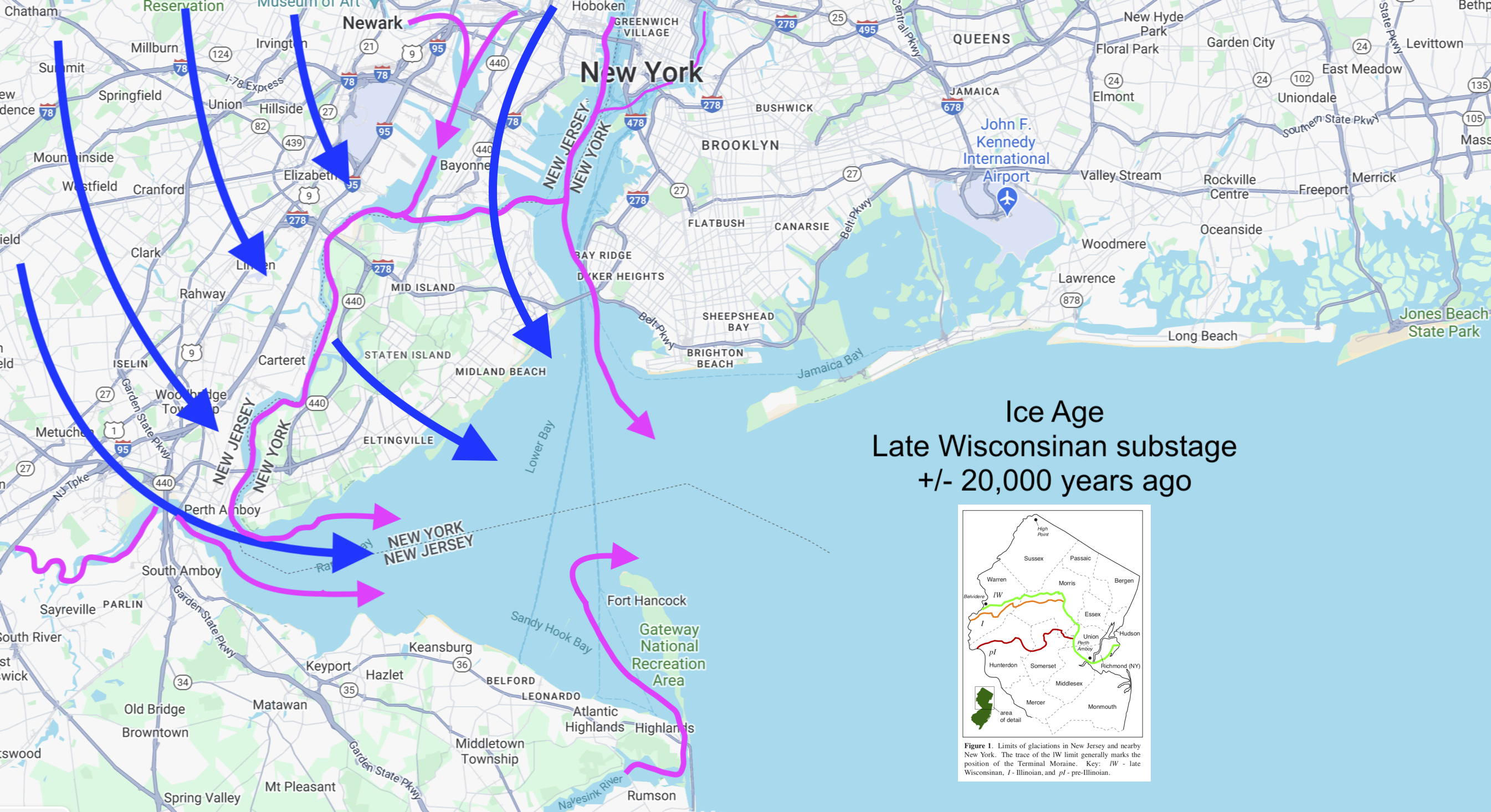
I took some down time and looked into the history of the Raritan Bay. You can read more about it HERE. In the several readings I found they talk about how these rivers, largest, large, and small, that feed into the Raritan and other bays empty into the New York Bight and terminate somewhere out near the Hudson Canyon. Duh, yeah, but there is a more complex story as to how and why it happened, like ice age stuff. The Bight heads east and meets, I don't mean anywhere close to land, the Gulf Stream to the south (warm water), and the Labrodor Current (cold water) to the north. The location of the true meeting of these three is probably around Stellwagen Bank HERE, and beyond, off of Masachusetts. They say those currents, and near where they meet, produce some of the best fishing. Think of things like Wicked Tuna off of Glouster, Mass. That's all way-above-my-pay-grade-stuff but you can read more of it HERE. Rather then try and reference things I just include a link, besides my interpretations may be askew. I don't know this stuff on my own.
The entire area around New York and New Jersey has a long and involved history, at least in a geological sense. The ice ages, well, had a ton of ice, called glaciers, back then. They reached thousands of feet high and they eventually melted, moved, slid, whatever, down towards the ocean. Eventually as they moved and cut into the earth and dragged sediment out with it it formed the rivers and bays. In one reading I found that the Hudson
Artwork- Archer
actually curved around to what we know now as the Rariatn River before it kind of straightened out and ended at the Upper (New York) Bay near where the East River meets it at the tip of Manhattan. Eventually things took shape as to basically what we see now. Then man came and messed it all up. The industrial revolution and the devlopment of large urban centers brought with them industrial and human waste which decimated the waters around them. Waters became an extension of a toilet bowl. Drains
replaced any kind of proper disposal of chemicals and by-products of production. At one time these waters provided a steady stream of fish and crustaceans from the bays and rivers around New York and from Philly to Trenton on the Delaware River. By the early 1900's waters had become dead and deadly if you drank or swam in them. It was that bad. Then through the decades the government stepped in and finally made some changes. The Federal Water Pollution Control Act was passed in 1948 and got the ball rolling. In 1972 more changes were made and became what we know as the Clean Water Act of 1972. With those laws waters improved, and life returned, albiet slower than some wanted. Ask some old time anglers about what the Raritan Bay used to look and smell like.
In my travels I have come to see firsthand, some places worse than others, how much humans have f'ed this planet up. These rivers and bays, most that travel in and around urban and industrial centers, have hammered these waterways and deposited more shit then the EPA and DEP could ever make right.

If the offending and toxic stuff is on land then they can cap it. Sediment, muck and mud, that are full of things that could kill anything, basically have to remain untouched. There's something to be said here, like, "If it's broke, don't fix it". If you disturb it it will make it worse.
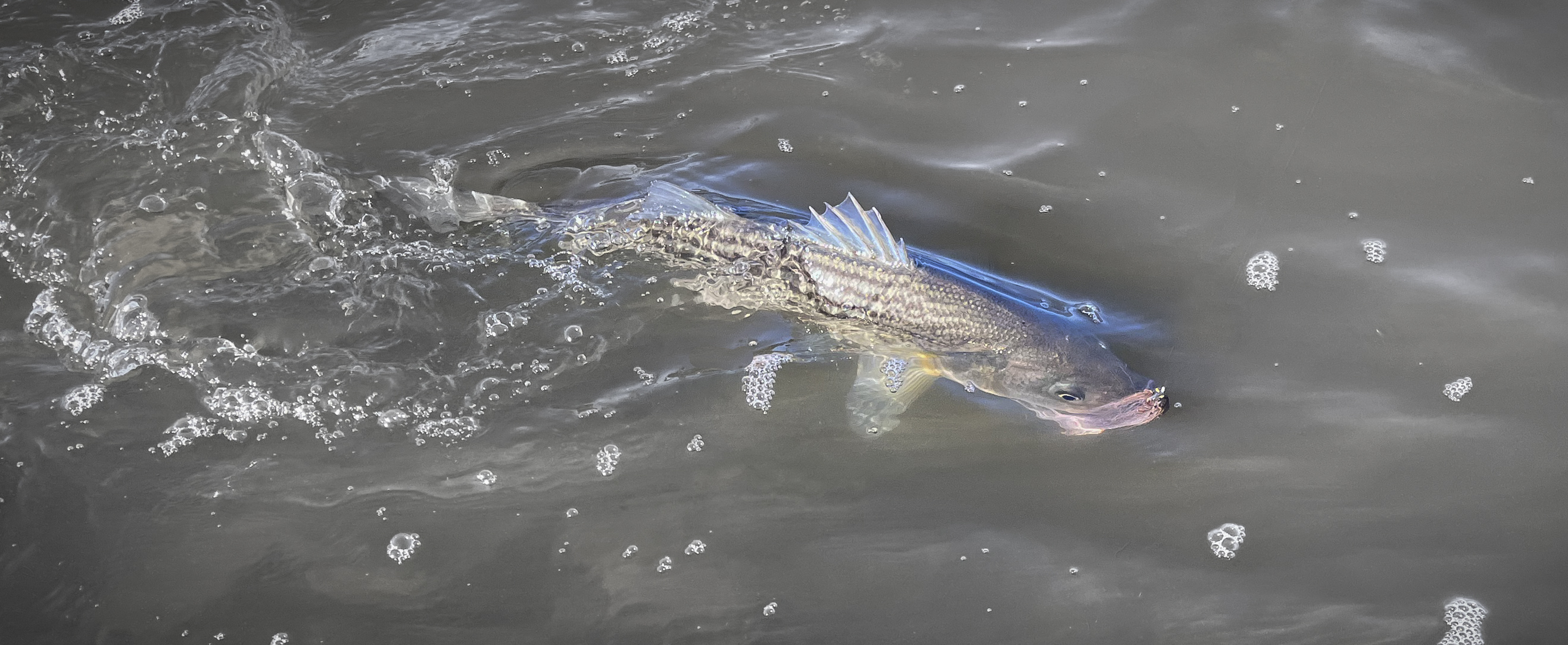
But what's amazing is that these waterways are seeing an increase in marine life each year. I started to look at the studies done after seine collections in various "nasty" waters and you know what, they look far worse to us then they do to the fish and crustaceans. My favorite catch that I saw was an alligator gar taken from the Hackensack River. They deduced it was a discard from an owner that could no longer care for it. But from the waters in and around Passaic, Hackensack, Newark, Linden, Bayonne, Perth Amboy, Laurence Harbor, Keyport, New Brunswick, Camden, Trenton, and Phillipsburg striped bass are returning there and staying put a lot more than you think.
So this wormhole I went down all started as I "fished" around waters old and new to hopefully find some fishy places to visit in 2024. That went from learning the boundaries and the proper names of the bays, to old history, to new history, and the problems that have plagued them and the people who called their banks home. But, through the works of several grass roots organizations, like the Hackensack Riverkeeper, people are starting to enjoy these waters as well as fishes that are starting to call them home, or a place to summer or winter over.